Participatory mapping Storytelling
Protecting the Rupununi Wetlands through Indigenous knowledge and spatial thinking
We have a new project in Guyana with Indigenous communities on spatial thinking funded by the National Geographic!
-
by Andrea
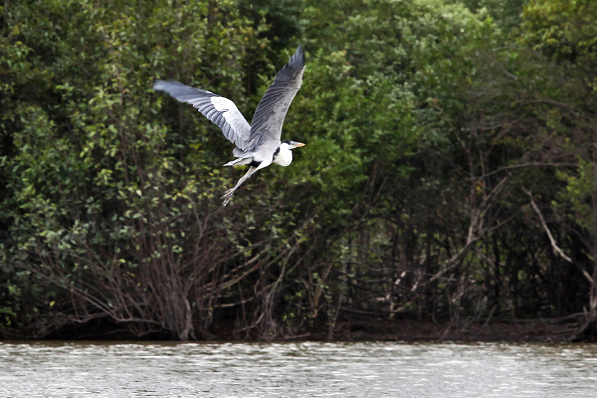
The Rupununi Wetlands in Guyana are among the most remarkable freshwater landscapes in the world. They are home to rich biodiversity, vital water systems, and Indigenous Wapishana and Makushi communities whose lives, livelihoods, and cultural identity are deeply connected to the land and water. For generations, these wetlands have sustained people, animals, and plants, but they are now facing increasing pressure from development, including the upgrade of the Georgetown-Lethem road that cuts through the region.
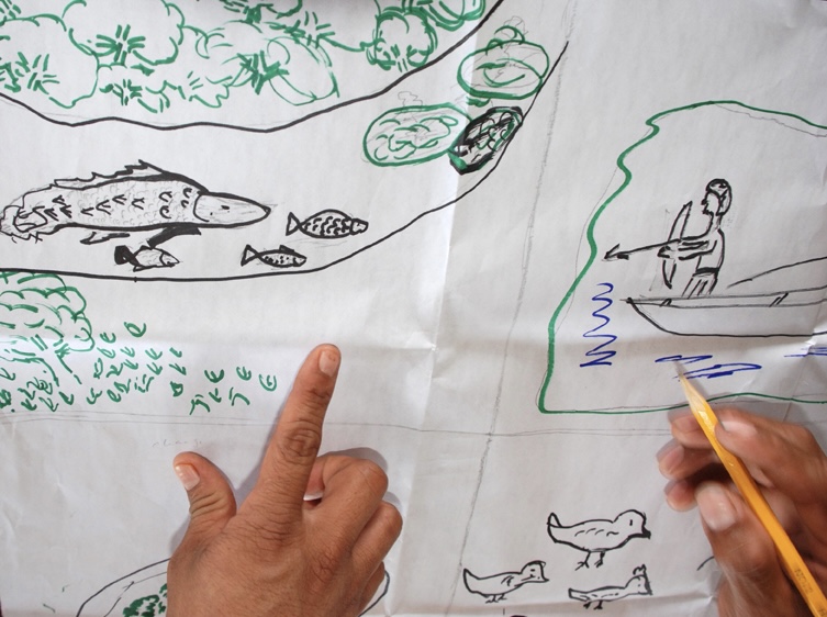
Through generous support from the National Geographic Society, our new project is built on a simple idea: if communities have the skills, knowledge and tools to better understand the spatial relationships that shape their territory, they will be better equipped to protect it. We want to work alongside Indigenous communities to combine traditional knowledge, oral histories, participatory mapping, and accessible environmental monitoring tools to create a deeper, shared understanding of the wetlands. This means helping people visualize how water moves across the landscape, how species depend on seasonal flooding, and how changes to one part of the system as a result of, for example, the road upgrade, can affect the whole.
This work is not starting from scratch. It builds on more than 25 years of collaboration in the Rupununi, led by the Cobra Collective with Indigenous partners. Over time, these relationships have grown into trusted partnerships grounded in respect, reciprocity, and shared learning. The project will bring together youth, elders, women, educators, and community leaders to co-create learning materials such as maps, seasonal calendars, storybooks, and heritage videos in both English and Indigenous languages. In doing so, it will support intergenerational learning and help strengthen cultural knowledge alongside ecological understanding.
At the heart of the project is a belief that Indigenous communities should not only be consulted, but should lead in managing their traditional territories. We hope this initiative will strengthen community capacity to monitor environmental change, support Village Sustainability Plans, and provide evidence that can inform advocacy and decision-making. Just as importantly, we hope it will help decision-makers see the wetlands not as empty space or a resource to be used, but as a living place with deep connections between water, territory, culture, and identity.
Personally, I hope this project will help protect a landscape that is both ecologically irreplaceable and culturally sacred. I hope it will give young people stronger reasons to value their heritage, and elders more opportunities to pass on their knowledge. I hope it will create practical tools that communities can use long after the project ends, and I hope it will show that when Indigenous knowledge and spatial thinking come together, they can offer powerful solutions for conservation and environmental justice.
In the end, this project is about more than maps or educational materials. It is about helping communities strengthen their voice, protect their future, and continue caring for the wetlands in ways that are rooted in their own knowledge and vision.